|
gm. Brochów, pow. sochaczewski, woj. mazowieckie
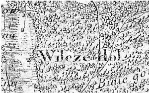
The village was settled by The Dutch probably at the end of the 18th century. In 1888, it had 9 homesteads and 172 morga of land.
Wilcze Śladowskie is a linear village located on the southern side of the Vistula to the south of Śladów, and on the southern side of the Sochaczew-Płock road. The buildings are modern, situated along the north-south road parallel to the drainage canal, which collects excess water from the area.
The cultural landscape on the western side of the road is well preserved with willows planted along dirt roads. The fields located on the eastern side have been afforested after that section of the village had been incorporated to the Kampinos National Park.
SGKP, t. X, 1889, s. 755.
|
)