|
gm. Dąbie, pow. kolski, woj. wielkopolskie
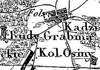
The village was a part of a church estate (owned by Gniezno archbishopric) and was settled by the Dutch colonists in 1779. In 1789, the village had 5 houses and 34 residents. The village was a part of a church estate (owned by Gniezno archbishopric) and was settled by the Dutch colonists in 1779. In 1789, the village had 5 houses and 34 residents. Grabina Mała is a linear village located to the north of Grabiny and to the northwest of Dąbie. Homesteads are located on the eastern side of the village road, which runs longitudinally. The cultural landscape associated with the Dutch colonization has been transformed. No examples of traditional architecture associated with the settlers are present. The colonists' cemetery has survived.
The cemetery lies southeast of the village next to the road to Grabiny. Its layout resembles a square; it is entirely overgrown with trees and bushes; its northern side is adjacent to a small forest. No gravestones have survived.
J. Goldberg, Osadnictwo ...
SGKP, t.II, 1881, s. 767.
|
)