|
gm. Dąbie, pow. kolski, woj. wielkopolskie
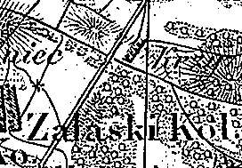
Zalaski was a gentry village (owned by Rupret Dunin) colonized by the Dutch settlers ca. 1789. In 1790, it had 6 houses. In 1895, the village comprised 4 houses and 45 residents. Zalaski is a linear village located to the northeast of Dąbie and to the west of the road to Kłodawa. Homesteads stretch mainly on the western side of a dirt road running through the village longitudinally. The cultural landscape characteristic of the Dutch colonization has survived. The village is located on a rise. The farmland descends towards ponds collecting the excess of ground water. The ponds are located to the west of the village. Scarce poplars, willows, and draining canals are present. No examples of traditional architecture associated with the settlers have survived.
J. Goldberg, Osadnictwo ...
SGKP, t. XIV, 1895, s. 328.
|
)