|
gm. Wartkowice, pow. poddębicki, woj. łódzkie
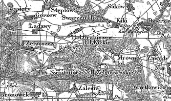
(Hol. Zelgoszczskie - Mapa Kwatermistrzostwa – 1830, Zelgoszcz - Mapa Chrzanowskiego - 1848)
Former village and grange situated in the Łęczyca poviat, Piaskowice commune, Solca Wielka parish. In 1827 it had 5 houses and 27 inhabitants. In 1880 the village was composed of 7 houses and 26 inhabitants; the grange had 2 houses and 6 inhabitants. Settled by the Hollander colonists at the end of the 18th century. Small linear village situated north of Kłodno, with contemporary homesteads located on both sides of the road. Traditional landscape related to the Dutch colonisation preserved in satisfactory state. The original location of settlements and road network are visible. Lack of material traces of colonists.
SGKP, T. I, Warszawa 1880, s. 565.
|
)