|
gm. Uniejów, pow. poddębicki, woj. łódzkie
(Hol. Brzezina - Mapa Kwatermistrzostwa – 1830, Bergfeld - Mapa Chrzanowskiego - 1848)
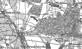
Village founded on government lands in 1792, after the 2nd partition of Poland, by some inhabitants of the Rhine region deported from Prussia. They planted vines and “settled as in their motherland”. Due to the unfavourable climate and other strokes of bad luck, at the beginning of the 19th century the settlement declined. In 1880, when it had 13 houses and 300 morgas of land, it was entirely Polish. Linear, medium size village situated latitudinally, north-west of Uniejów, with the majority of homesteads located on the northern side of the road. Traditional landscape related to the Dutch colonisation illegible. Lack of material traces of colonists.
SGKP, T. I, Warszawa 1880, s. 416.
|
)