POLISH VERSION


Home | Introduction | Download e-book | Conference 2001 | Special thanks | The note of law | Contact
Articles: Poland | Małopolska | Mazowsze | Ziemia Łęczycka | Żuławy | Nizina Sartowicko-Nowska | Ziemia Kwidzyńska | Ziemia Walichnowska | Ziemia Sieradzka | Ziemia Wieluńska
Dutch villages --> Ziemia Sieradzka
Cichmiana Dolna
Następna miejscowość Next village
Explanations
Map of district

gm. Dąbie, pow. kolski, woj. wielkopolskie

(Hol. Chwalborskie - Mapa Kwatermistrzostwa – 1830, , Chwalborskie Hol. - Mapa Chrzanowskiego - 1848)

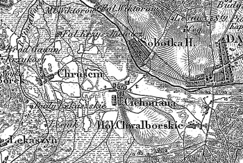
Village situated in the former Turek poviat, Kotniki commune, Chwalborzyce parish. Settled by the Hollander colonists at the beginning of the 19th century. In 1827 it had 14 houses and 163 inhabitants.

Linear, medium size village situated longitudinally, with the majority of homesteads located on the western side of the road.

Landscape related to the Dutch colonisation transformed, illegible. Lack of material traces of colonists.

    
SGKP, T. I, Warszawa 1880, s. 656.


Home | Introduction | Download e-book | Conference 2001 | Special thanks | The note of law | Contact
Articles: Poland | Małopolska | Mazowsze | Ziemia Łęczycka | Żuławy | Nizina Sartowicko-Nowska | Ziemia Kwidzyńska | Ziemia Walichnowska | Ziemia Sieradzka | Ziemia Wieluńska

Copyright 2005 © jerzyszalygin@wp.pl